Showing posts with label Tramping. Show all posts

29 January 2019

South Island Tour


Tell me about a complicated man.
Muse, tell me how he wandered and was lost
when he had wrecked the holy town of Troy,
and where he went, and who he met,
the pain he suffered in the storms at sea.
- Homer The Odyssey (modern translation)


The road to Mt Cook.


We have just returned from another epic Highstead adventure. Sixteen days of driving, tramping, and camping on the South Island. The trip was undertaken during the height of summer holidays and tourist season around here, so we designed our route to avoid the crowds as much as possible. In total, we covered a little over 3,400 km (2,100 mi), almost entirely on minor highways and roadways. A surprising amount of it was on unsealed/gravel roads. Along the way, we stayed in a mixture of small baches/cribs intermingled with a lot of tent camping. Despite the huge crowds out at this time of year, we felt like we had the roads mostly to ourselves.

Most people touring the South Island are a little limited in their choice of route. There are only a few places to pick up a hire car or campervan, and the most popular seems to be Christchurch. From there, the most common route is to head north and do a big anti-clockwise loop. We were fortunate to be arriving into Picton by ferry and knew we could start in either direction. Additionally, we had already spent time in Christchurch/Akaroa (Link: Moving Pictures & Signals) as well as in Dunedin (Link: Summertime & One Tonne) and Oamaru (Link: Steampunk'd), so we could skip the southeast coast. In the end, our route took us clockwise from Picton to Kaikoura, then inland to the Rakaia Gorge and onto Mt Cook. From there, we jumped down to the Catlins, bypassed Invercargill, and headed for the Fjordlands. We finished our trip on the West Coast. Camping and sleeping in a tent meant that we had no schedule and nowhere to be. We could drive as far as we wanted, pitch our tent, and explore the local area. Every few nights, we stayed in a bach/crib so we could dry out, shower, and do some laundry.


Day 1-2 - Palmy to Wellington, Picton to Kaikoura

Loading the ferry - Wellington to Picton.


Te Moana-o-Raukawa is the tempestuous strip of water that separates New Zealand's South and North Islands. The English name is Cook Strait, and it is considered one of the most dangerous and unpredictable bodies of water in the world. The narrowest part of the strait is only 22 km wide, but the ferry crossing between Wellington and Picton takes about 3.5 hours. On the South Island, the section through Marlborough Sounds is one of the most scenic and dramatic that I have ever experienced. This would be my 5th crossing, and the ferry was packed, so we claimed some space, stayed below, and camped out for the journey. Despite the strait’s terrible reputation, I have never experienced a difficult crossing, but JRH did on her way to school camp a couple of years ago. Their crossing was so rough that cars slid around on deck and smashed into each other.

Picton to Kaikoura is another 2 hour drive, making for a lot of sitting/driving on our first day of travel. The original plan for our trip was to limit driving to only 3-4 hours each day. We wanted to explore the South Island, not zoom through it. Unfortunately, there was no way to avoid a couple of long days. Fortunately, we couldn't check into our bach until after 5p, so we weren't in much of a hurry. This time of year, the sun rises at about 5:30 and doesn't set until after 9:30p, giving us plenty of light well into the evening. Unfortunately, the weather didn't cooperate (skies were grey and overcast) and much worse, we lost our Lonely Planet guide, so we didn't take any side trips or detours. Our goal was lunch at Nin's Bin ... a roadside trailer serving what is reportedly some of the best local seafood. Seating is outside only and it was raining. We weren't prepared to brave "liquid sunshine" on our first day, so we passed it by. We had 15 days of outdoors adventures planned, and particularly on the west coast where it rains 200+ days each year, doing things in the rain would become a theme ... just not on Day 1.


Te Ahi Kaikoura a Tama ki te Rangi (Kaikoura) was established in 1853 as a whaling station, and it's name means "Meal of Crayfish" (crayfish here being what the rest of us call spiny lobster). Crayfish is on the menu all over town, but some of the best food here is at roadside trucks/trailers. Since we missed out on Nin's Bin on Day 1, the next day saw us picking up the slack at Kaikoura Seafood BBQ. Like anywhere else in the world, crayfish/lobster here is crazy expensive and JRH was shocked when she saw the sticker price on the tail we ate for lunch. She doesn't eat seafood, so couldn't experience for herself how each bite was worth every penny.

On 14 November 2016, there was a magnitude 7.8 earthquake centred approximately 60 km south-west of Kaikoura. The quake occurred at a depth of only 15 km, involved 6 different fault lines, and was comprised of two separate but concurrent events. I went into a lot of detail regarding the science and our experience here. Suffice it to say that it was a life-changing event for both Kari and me. While we felt quite a rumble 150 km away, the local results were devastating. New Zealand sits on the Ring of Fire, one of the most geologically active areas in the world, and the seabed surrounding Kaikoura has been rising at a rate of a few mm per year, but the Kaikoura earthquake instantly raised the seabed 0.5-2 metres. It completely changed the landscape, altering reefs, fisheries, and fur seal colonies. In addition, nearly 200 km of road was damaged along with an equal amount of rail line. Opening the only major roadway into Kaikoura took a little more than a year, required over 2 million work hours, and came at a cost of over $1.1 billion.


Kaikoura's alien landscape.


One of the things we have discovered on our travels is that you just can’t do it all. Everywhere we go, there is so much to see and do but just not enough time to fit it all in. Our strategy is to identify a bunch of things we would like to do, then each of us gets to pick one thing that we absolutely will do. For this trip, my choice was sea kayaking. Up and down the coastline there are dozens of places to put a kayak in and go for a paddle ... and plenty of companies willing to take your money to see it all happen. Unfortunately, for most of them, JRH was not old enough. In Kaikoura, though, we found one that was more “family friendly”. We chose the morning paddle hoping for better weather and we weren’t disappointed.

Once they got us all to the put-in and gave us a safety briefing (in the event of an earthquake or tsunami, paddle further out to sea to deeper water!), we were on our way. With the size of our group, they split us into two, so the three of us were lucky to have our own private guide. She got us right up close to some seals and let us paddle out into the ocean swells. Maria was awesome and I can’t say enough great things about Kaikoura Kayaks.


On the water with Kaikoura Kayaks.


Shoreline exploring.


Summer in these latitudes means long days with loads of sunlight. After our paddle, we had time for lunch followed by a long tramp along the shoreline then back along the cliffs. That still left us plenty of time to get back to our bach, shower, and head out for some sunset views and a late dinner. All in all, it was a great start to our long holiday.


Stay tuned, there's more to come ...

10 October 2018

Kapiti Island


Ka tito au
Ka tito au
Ka tito au ki a Kupe 
Te tangata
Nana i topetope tu wenua
Tu ke Kapiti 
- Te Rauparaha (1847), composed during his imprisonment aboard HMS Calliope


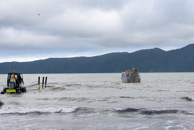
Private boat ramps on Waiorua Bay, Kapiti Island.  Photo: RGH


Driving to and from Wellington along the Kapiti Coast, when looking seaward the horizon is dominated by a large island. Kapiti Island sits just far enough offshore to appear perpetually verdant, mysterious, and unoccupied. Always looking for new places to explore, Kari discovered that it is an ecological reserve and is accessible for day trips and overnight stays. The island boasts an abundance of native plants and endemic birds, including the elusive Little Spotted Kiwi. It is one of the few places in New Zealand where one has a good chance of spotting a Kiwi (bird) in its native habitat. During our previous year here, Kari wanted to venture across Rau O Te Rangi channel and visit the island, but it was only after returning here permanently a few months ago that we were finally able to do so.

The island covers almost 20 sq km (8 sq mi), only a tiny portion of which is accessible for tramping. Almost the entirety is closed to the casual visitor and is set aside as a wildlife sanctuary. There is a limit to the number of visitors each day (100 to Rangatira, 60 to the North end). Interestingly, 13 hectares (32 acres) is privately owned by members of the Ngati Toa, Te Āti Awa, and Ngāti Raukawa Confederation. Many of them are whanau descended from an extraordinary woman, Utauta Webber, who refused to give up her land despite relentless government pressure to do so. One hundred twenty-one years after the Kapiti Island Reserve Act was established, whanau continue to live and work on Kapiti.


Paraparaumu to Kapiti Island.  Photos: RGH


John Barrett and Amo Barrett, Utauta Webber's grandchildren, established Kapiti Island Nature Tours by renovating the family bach and offering a unique homestay to visitors. Manaaki Barrett, John’s son and our host/guide for the weekend, grew up visiting the island and is now slowly assuming more responsibility for the daily operations of the business. It is truly a whanau affair, structured so that as many whanau as possible can be sustainably employed and maintain ties to their ancestral lands. Maori was not initially a written language and their history was kept alive through oral story-telling. We were captivated by Manaaki’s ability to narrate the history of his whanau and iwi, and deftly weave it into their story today.


Kapiti Island Nature Tours.  Photos: RGH & KAH


Utauta’s great grandfather, Te Rangihiroa, accompanied Te Rauparaha when Ngati Toa first seized the island in the 1820s. They successfully defended their occupation in the Battle of Waiorua (1824) when multiple iwi allied against them and tried to push them off. For Ngati Toa, Kapiti Island became a fortress and base from which to trade and launch marauding attacks. Ngati Toa developed trading relationships with whalers and fishermen from Europe and the Americas, encouraging them to live amongst them and accept Maori custom. Some married Maori women and were adopted into the tribe. As their cultures clashed, strife occasionally devolved into violence. In his book Kapiti, Chris Maclean describes Kapiti in the 1830s as “a wild frontier, a meeting point of two cultures without the restraints of law or government.” By the 1830s, the British had begun to establish a more consistent presence in the region, first sending HMS Zebra in 1833, then HMS Rattlesnack in 1838. The Treaty of Waitangi (1840) established British sovereignty in New Zealand and coincided with the decline of whaling in and around Kapiti. Whaling gave way to farming as a way of life, which only hastened the loss of native species.


Tramping through the nature reserve.  Photos: RGH & KAH


Tuteremoana summit and Western cliffs overlook.  Photos: KAH


Like much of the world, New Zealand has suffered the scourge of introduced species. Prior to the capture of Kapiti Island by Ngati Toa, the human impact would have been limited to subsistence living, supported by the abundant marine life and bird species, bouyed by limited cultivation of kumara. After their occupation, the population swelled to over 1000 people and new areas were cleared for food crops. The easiest way to clear land was by burning. Occasionally, controlled burns became wildfires that swept the island. New Zealand plants and birds evolved in relative isolation, free from predators and grazing mammals. Cattle, goats, sheep, and possum were introduced by European visitors to the island, and pests such as stoats and rats established substantial colonies. The introduction of these species proved devastating. When the island became a reserve in 1897, native plants and bird populations were finally able to begin a slow regeneration.


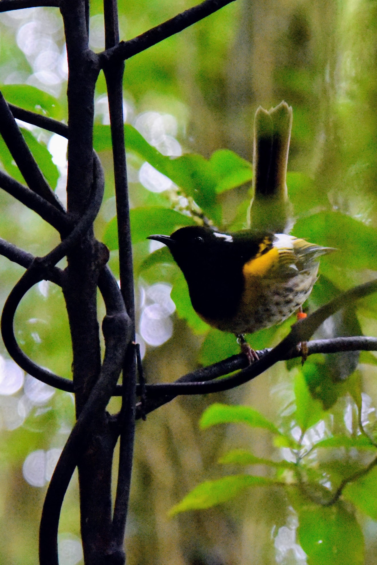
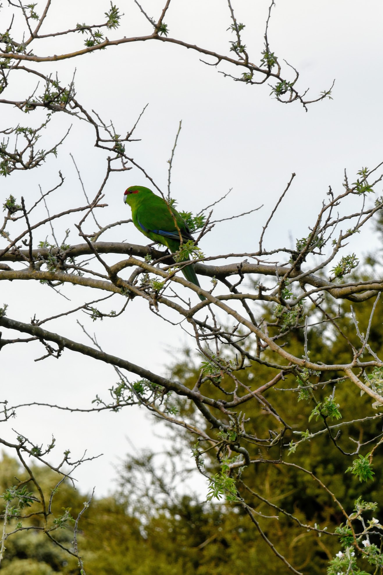
Hihi & Kakariki.  Photos: KAH

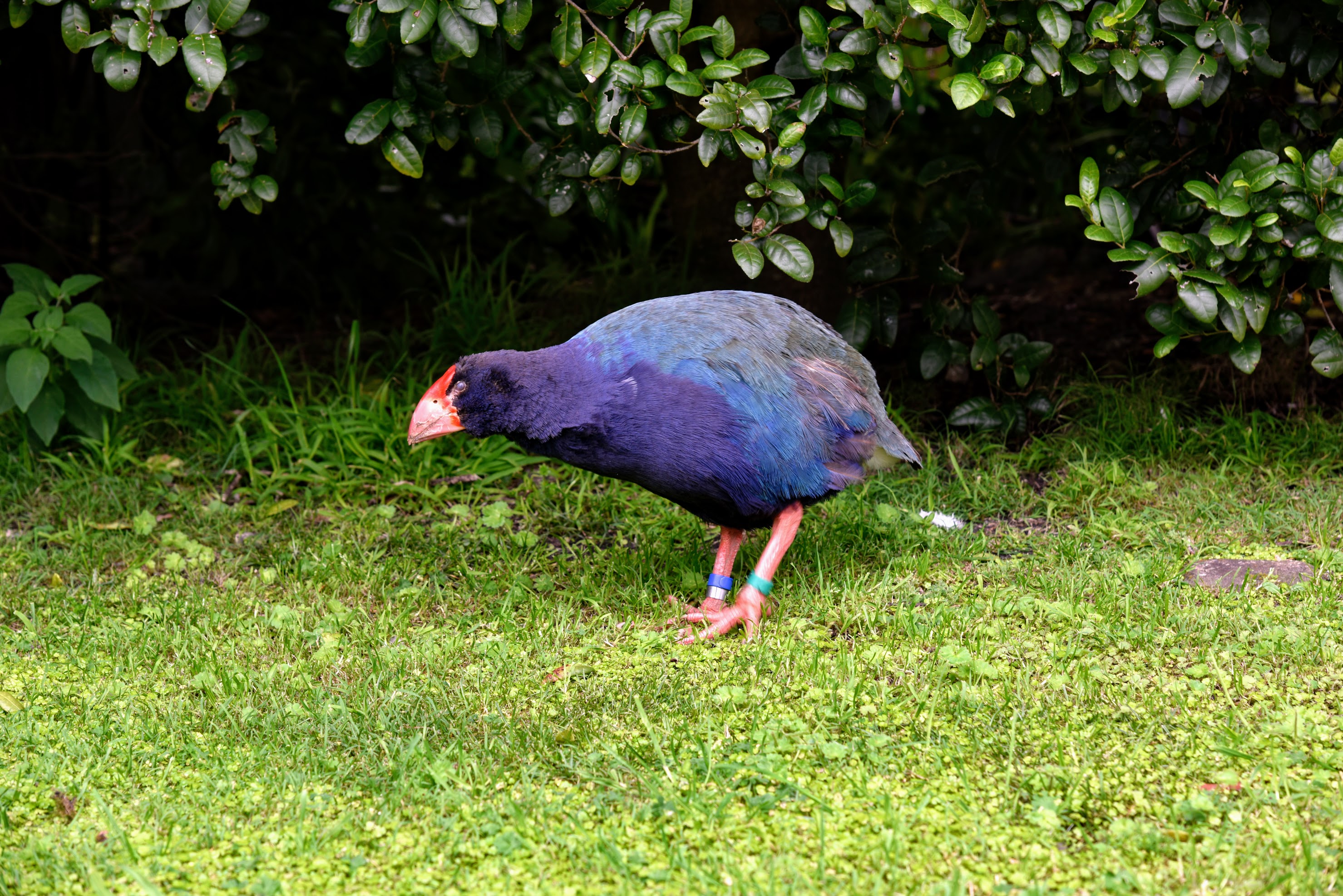
Takahe.  Photo: KAH

Kereru.   Photo: KAH

  
Kaka.   Photos: RGH


By 1917, a campaign to clear the island of grazing mammals and predatory pests had begun, but  limited farming continued on the island into the 1950s. It would take almost 80 years before the last rat, and last mammalian pest, would be cleared from the island and endemic species could flourish. Visiting the island today, it is the abundance and variety of native birds that are most impressive. Supported by the regeneration of native plant species, some have rebounded from in-place populations, while others have had to be re-introduced. This concerted effort to restore native bird species, with Kapiti Island acting as a “life raft”, has been so successful that some are transplanted from the island to bolster or re-establish populations elsewhere in New Zealand.


Sunrise over Waiorua Bay.   Photo: RGH

Manuka & view of Northern shore from Western cliffs.  Photos: KAH


Kapiti Island is one of the few areas where you might chance to see a Kiwi bird in the wild. "Might chance" is a bit of a misnomer ... we set out late at night with Wayne, one of the year-round residents, in search of these hard-to-find birds. Kapiti Island is far enough from the mainland that there is little light pollution, and it was a cloudy, nearly moonless night. More than once, I bumped into the person in front of me when they stopped abruptly. Using a light shrouded with red cellophane, Wayne crawled around on his belly looking into the dense underbrush. There were 13 of us split into two groups, and ours was the only one to actually spy a Little Spotted Kiwi in the bush. Admittedly, it was a bit anti-climactic, but it was pretty awesome none-the-less.


One of New Zealand's many great small breweries.


The next morning, the skies were clear and the sun was shining. We opted to take the afternoon boat back across Rau O Te Rangi channel, giving us a chance for a morning tramp to the top of the Western cliffs. After lunch, we set out on a guided tour of the Northern shoreline and bird nesting area. We thought we would be a little late getting to the boat landing, but were there in plenty of time to sit for a spell. Once across to the mainland, we stopped to slake our thirst and eat our fill of pizza at the Tuatara Brewery, then it was on to home.


Rats ...


23 May 2017

The Long Goodbye


It's a long, long road
From which there is no return
While we're on the way to there
Why not share
And the load doesn't weigh me down at all
- Bobby Scott / Bob Russell He Ain't Heavy, He's My Brother


Road-trippin' with the Beastie Boys blaring.


With each of our moves from place to place, new cities, and new homes, we have met some truly extraordinary people. Some of them we have been fortunate enough to call "friend". From Texas to Washington DC, on to Iowa, and then to South Carolina, every place we lived has been a change in culture and environment. Moving half a world away to New Zealand was sure to provide its own unique challenges and triumphs. New Zealanders are an interesting lot. Every Kiwi I have ever met abroad has been open and friendly to the point of being gregarious. Prior to moving here, I was surprised to read people complain about how difficult it is to establish a social group that includes local people.

When we first arrived, it was understandable, though a bit disappointing, that most of the people we met and socialised with were other expats. There is something comforting about hearing a familiar accent, complaining about the groceries and produce, or playing the "what do you miss the most?" game. "Kiwis are friendly but not friend-making", "Kiwis have a wide range of acquaintances and a small group of friends" are two of the things I read that stuck with me. Our experience has shown this to be true. As we have (slowly) expanded our group of friends to now include Kiwis, many of them have agreed with this assessment. Kiwis are a close-knit group. Of course, our own bias colours our perception. In many parts of the world Americans are seen to be uncomfortably friendly!

There is some added complexity given what I do for a living. Emergency Medicine physicians miss out on birthdays, anniversaries, weddings, soccer games, recitals, and other important family events. Sometimes it can feel like we see more of our ED family then we do of our own. Naturally, our social group is often comprised of doctors, nurses, and other ED staff. Our daily experiences reach a level of violence, trauma, and drama that few who haven't been a part of it would understand. We say things to each other that we couldn't possibly say aloud in other company. Our gallows humour, one of a variety of defense mechanisms, often crosses from borderline into completely inappropriate. Together, we celebrate small victories, weather crushing defeats, and find ways to carry each other through to the end of a shift with enough left to return for the next.

The culture in New Zealand has been a refreshing change from the "with your shield or on it" expectations of practicing in the U.S. Kiwis have a much better sense of work/life balance. I have always taken the position that I work to live, not the other way around. Here, not only is that accepted, it's supported. As part of my contract, I get 30 days of paid leave ... and I'm expected to use it. My original plan was to bank most of that time and use it at the end of my contract, allowing us to travel for a month before returning home. I was told in no uncertain terms that would not work. "We give you time off for a reason." As a result, I have tacked a couple of days of leave onto either side of long weekends so we can travel throughout the year. This has been amazing for our family.
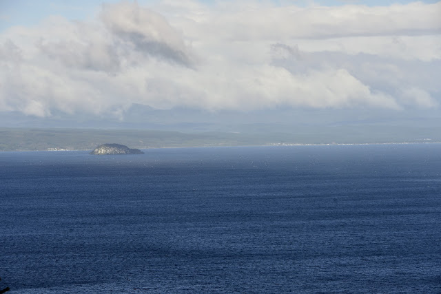
Since most of my social group is comprised of other ED doctors, it can be difficult to find time just to hang out together. Emergency Medicine physicians work days, nights, week-ends, and holidays. The ED is always open, so there is at least one of us who can't make it to any given event. Sadly for us, one of our ED docs is returning to the U.S. after living and working here for three years. Matt and I have similar interests ... whisky, mountain biking, wine, tramping, whisky. His leaving was the perfect opportunity to plan a guys' week-end away. We recruited Tom, one of the other ED docs who also enjoys booze, bikes, and tramps (just a reminder for my NA readers, a "tramp" in NZ is a hike).


I love it when a plan comes together.  Photos - G. Highstead / T. Carter


Kari, Little H, and I had just finished the Tongariro Crossing (Link: In The Shadow of Mt Doom) and I desperately wanted to tackle it again. Matt was in ... one last tramp before he left ... and Tom was just as excited. The hardest part was finding three days where we could all be free from work and family. We made plans in March ... for a week-end in May. The week-end we chose happened to coincide with my birthday, an added bonus. The biggest issue with a late May trip to the Tongariro is weather. After early April, it's hit or miss. By June, the crossing is all but impassable without crampons, ice axes, and other winter mountaineering gear. As much as I pretend to be a bad-ass, an 8-9 hour alpine trek through volcanic craters and along frozen ridge-lines in freezing temperatures and gale-force winds just doesn't have the appeal that it used to.


You're not hardcore
Unless you live hardcore
- Jack Black


As the days ticked by, I was glued to the weather reports. In April, a storm blanketed the region in sleet and snow, but it cleared within a few days. In the week before our trip, an Antarctic blast moved in from the south. If we were lucky, it would hit mid-week and leave a weather window to make the Crossing on Saturday or Sunday. In the end, the system hit late and good weather wasn't anticipated until the following Monday. We drove up Friday night as planned, and Saturday morning had to look for other tracks to tackle. The storm system made it pretty wet and windy, especially at elevation, but at least we didn't get snowed on.


Matt and Tom looking out over the lake during a rare break in the cloud cover.


We have previously written about the Maori legends surrounding the still active mountains in the Taupo Volcanic Zone (Link: Baches and Cribs and The Land That Time Forgot). Situated in the geographic centre of the North Island, Lake Taupo is in the caldera of the Taupo Volcano. It is the second largest fresh-water lake in Oceania. Tourism is the driving economic force for the area and throughout the summer Taupo hosts bike races, running races, triathlons, and water-sport events. It can be quite difficult to get in and around town, so we haven't spent much time there. At the end of fall, tipping into winter, it felt like we had the town much to ourselves.

The lake itself is large enough to have a temporizing effect on the local climate. While it was snowing and sleeting at altitude only a few kilometres away, the ridgeline bordering the lake was shrouded in rain clouds. We chose to hike a track called W2K, a section of the Great Lake Trail. Including a connection to the Headland Loop Track, we tackled 22.5 km. Most of the trail was covered in forest with occasional look-outs over the lake. We were quite fascinated by the different lichens, mosses, and plants in each of the micro-climates we tramped through.


Views from the W2K Track


22.5 km makes for a lot of walking for three old men. By the end of it, we were ready to sit down for a hot meal and a beer. The original plan was to go soak in the local hot springs at Spa Park, but the miserable weather drove us back to the bach and its hot-tub. Fortunately, we had the foresight to pre-stock the fridge with a case of beer. While we were enjoying our time on the trail and our post-tramp soak, the wind and snow continued to blow in the mountains. That evening I got a text from Kari informing us that our primary route home, the Desert Highway, was closed.

The next morning, the road was still closed, forcing us to detour along minor highways west of the mountains. It's a spectacular drive, and one we have made previously. The views of Tongariro, Ngauruhoe, and Ruapehu are quite majestic from the west. I had never before seen them blanketed in snow, and they didn't disappoint.


 Tongariro with Lake Rotoaira in foreground. The saddle to the right of centre is where the final descent of the Tongariro Crossing begins.
Compare the large island front left to the next picture.

View from the saddle during our Crossing in March. Lake Rotoaira below with the island seen in the previous picture, this time off to the right.
Lake Taupo in distant background.

Tongariro


The day was cold and the air was crisp. There were just a few whisps of cloud in the brilliant blue sky. We were quite amazed to watch the mountains form their own weather patterns. Clouds would coalesce around the mountains, obscuring the peaks, then blow away. Within seconds, new clouds would form and blow away. Wash, rinse, and repeat.


Tongariro and Ngauruhoe

Ngauruhoe - Photo T. Carter


We continued our trek around the volcanoes, eventually landing in Ohakune. Matt is a huge fan of a good burger ... something decidedly difficult to find in this country ... so of course I had to take him to my favourite burger joint, The Blind Finch. They expanded their menu since the last time I was there. I had a burger I hadn't tried before and an order of poutine, another food item difficult to find in New Zealand. Poutine is a French-Canadian dish in which french fries are mixed with cheese curds and drenched in light-brown gravy. Heaven on a plate! The most memorable poutine I have ever tasted was the Roast Duck Poutine at Bannock in Toronto, but I still enjoy a classic poutine made with just fries, curds, and gravy. Unfortunately, we have yet to find cheese curds here in New Zealand and the gravy just isn't right. Still, it was nice to have a little taste of home on a wintry day in a small ski town in the centre of Aotearoa.

As Matt prepares to leave us here, I can't help but think of our own pending departure. Our Eurail passes arrived today and we are making plans for our traipse through Europe. Starting in Tokyo, we will visit 9 cities before landing in NYC. It will be a Planes, Trains, and Automobiles adventure (hopefully) without the mishaps.


Hei konei ra ...