Tell me about a complicated man.
Muse, tell me how he wandered and was lost
when he had wrecked the holy town of Troy,
and where he went, and who he met,
the pain he suffered in the storms at sea.
- Homer The Odyssey (modern translation)

The road to Mt Cook.
We have just returned from another epic Highstead adventure. Sixteen days of driving, tramping, and camping on the South Island. The trip was undertaken during the height of summer holidays and tourist season around here, so we designed our route to avoid the crowds as much as possible. In total, we covered a little over 3,400 km (2,100 mi), almost entirely on minor highways and roadways. A surprising amount of it was on unsealed/gravel roads. Along the way, we stayed in a mixture of small baches/cribs intermingled with a lot of tent camping. Despite the huge crowds out at this time of year, we felt like we had the roads mostly to ourselves.
Most people touring the South Island are a little limited in their choice of route. There are only a few places to pick up a hire car or campervan, and the most popular seems to be Christchurch. From there, the most common route is to head north and do a big anti-clockwise loop. We were fortunate to be arriving into Picton by ferry and knew we could start in either direction. Additionally, we had already spent time in Christchurch/Akaroa (Link: Moving Pictures & Signals) as well as in Dunedin (Link: Summertime & One Tonne) and Oamaru (Link: Steampunk'd), so we could skip the southeast coast. In the end, our route took us clockwise from Picton to Kaikoura, then inland to the Rakaia Gorge and onto Mt Cook. From there, we jumped down to the Catlins, bypassed Invercargill, and headed for the Fjordlands. We finished our trip on the West Coast. Camping and sleeping in a tent meant that we had no schedule and nowhere to be. We could drive as far as we wanted, pitch our tent, and explore the local area. Every few nights, we stayed in a bach/crib so we could dry out, shower, and do some laundry.
Day 1-2 - Palmy to Wellington, Picton to Kaikoura


Loading the ferry - Wellington to Picton.
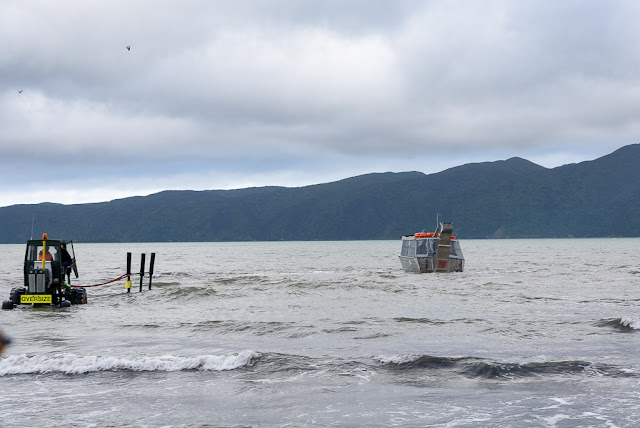
Te Moana-o-Raukawa is the tempestuous strip of water that separates New Zealand's South and North Islands. The English name is Cook Strait, and it is considered one of the most dangerous and unpredictable bodies of water in the world. The narrowest part of the strait is only 22 km wide, but the ferry crossing between Wellington and Picton takes about 3.5 hours. On the South Island, the section through Marlborough Sounds is one of the most scenic and dramatic that I have ever experienced. This would be my 5th crossing, and the ferry was packed, so we claimed some space, stayed below, and camped out for the journey. Despite the strait’s terrible reputation, I have never experienced a difficult crossing, but JRH did on her way to school camp a couple of years ago. Their crossing was so rough that cars slid around on deck and smashed into each other.
Picton to Kaikoura is another 2 hour drive, making for a lot of sitting/driving on our first day of travel. The original plan for our trip was to limit driving to only 3-4 hours each day. We wanted to explore the South Island, not zoom through it. Unfortunately, there was no way to avoid a couple of long days. Fortunately, we couldn't check into our bach until after 5p, so we weren't in much of a hurry. This time of year, the sun rises at about 5:30 and doesn't set until after 9:30p, giving us plenty of light well into the evening. Unfortunately, the weather didn't cooperate (skies were grey and overcast) and much worse, we lost our Lonely Planet guide, so we didn't take any side trips or detours. Our goal was lunch at Nin's Bin ... a roadside trailer serving what is reportedly some of the best local seafood. Seating is outside only and it was raining. We weren't prepared to brave "liquid sunshine" on our first day, so we passed it by. We had 15 days of outdoors adventures planned, and particularly on the west coast where it rains 200+ days each year, doing things in the rain would become a theme ... just not on Day 1.

Te Ahi Kaikoura a Tama ki te Rangi (Kaikoura) was established in 1853 as a whaling station, and it's name means "Meal of Crayfish" (crayfish here being what the rest of us call spiny lobster). Crayfish is on the menu all over town, but some of the best food here is at roadside trucks/trailers. Since we missed out on Nin's Bin on Day 1, the next day saw us picking up the slack at Kaikoura Seafood BBQ. Like anywhere else in the world, crayfish/lobster here is crazy expensive and JRH was shocked when she saw the sticker price on the tail we ate for lunch. She doesn't eat seafood, so couldn't experience for herself how each bite was worth every penny.
On 14 November 2016, there was a magnitude 7.8 earthquake centred approximately 60 km south-west of Kaikoura. The quake occurred at a depth of only 15 km, involved 6 different fault lines, and was comprised of two separate but concurrent events. I went into a lot of detail regarding the science and our experience here. Suffice it to say that it was a life-changing event for both Kari and me. While we felt quite a rumble 150 km away, the local results were devastating. New Zealand sits on the Ring of Fire, one of the most geologically active areas in the world, and the seabed surrounding Kaikoura has been rising at a rate of a few mm per year, but the Kaikoura earthquake instantly raised the seabed 0.5-2 metres. It completely changed the landscape, altering reefs, fisheries, and fur seal colonies. In addition, nearly 200 km of road was damaged along with an equal amount of rail line. Opening the only major roadway into Kaikoura took a little more than a year, required over 2 million work hours, and came at a cost of over $1.1 billion.


Kaikoura's alien landscape.
One of the things we have discovered on our travels is that you just can’t do it all. Everywhere we go, there is so much to see and do but just not enough time to fit it all in. Our strategy is to identify a bunch of things we would like to do, then each of us gets to pick one thing that we absolutely will do. For this trip, my choice was sea kayaking. Up and down the coastline there are dozens of places to put a kayak in and go for a paddle ... and plenty of companies willing to take your money to see it all happen. Unfortunately, for most of them, JRH was not old enough. In Kaikoura, though, we found one that was more “family friendly”. We chose the morning paddle hoping for better weather and we weren’t disappointed.
Once they got us all to the put-in and gave us a safety briefing (in the event of an earthquake or tsunami, paddle further out to sea to deeper water!), we were on our way. With the size of our group, they split us into two, so the three of us were lucky to have our own private guide. She got us right up close to some seals and let us paddle out into the ocean swells. Maria was awesome and I can’t say enough great things about Kaikoura Kayaks.


On the water with Kaikoura Kayaks.


Shoreline exploring.
Summer in these latitudes means long days with loads of sunlight. After our paddle, we had time for lunch followed by a long tramp along the shoreline then back along the cliffs. That still left us plenty of time to get back to our bach, shower, and head out for some sunset views and a late dinner. All in all, it was a great start to our long holiday.

Stay tuned, there's more to come ...


