I got my toes in the water
Ass in the sand
Not a worry in the world
A cold beer in my hand
Life is good today
- Zac Brown Band
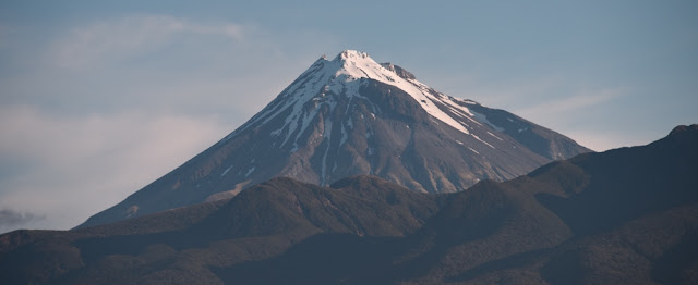
Mount Taranaki
In New Zealand, a (generally) small, modest holiday home is called a "Bach" (pronounced batch) ... in the southern reaches of the South Island, they are known as "Cribs". The origin of the term isn't really clear. They are typically a family home, so it isn't likely to refer to a bachelor pad. Regardless, they are places to escape to.
We have started to think about excursions during our year here, and have come upon a mix of accommodation styles that we think will suit us well. The trail systems in New Zealand are often dotted with huts. These are small bunkhouses, some without water, heat or electricity, and some with just the basics. We have a few 1-2 night hikes that we are planning and we will stay in the huts for those. We are also trying to organize a canoe trip down the Whanganui River, and for that we will camp on the riverside, sleeping in a tent.
This week-end, we went to Oakura and stayed in a Bach. Oakura is a small community on the "Surf Highway" just south of New Plymouth. Its two main attractions are a bar/restuarant/entertainment venue and an amazing beach. Our plan was to stay and play on the beach, then spend some time hiking on Mount Taranaki.
At the last minute, Kari's brother decided to fly in for two weeks (Yay, our first visitor!), so we dragged him along.
True to form, we packed too much and forgot much of what we needed, got on the road a little later than planned, and missed a turn along the way adding a good chunk of time to what was already going to be a 4+ hour drive. Regardless, we arrived in plenty of time to get a quick walk on the beach then head into New Plymouth for an amazing dinner.
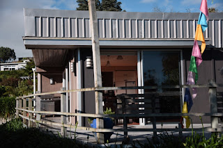


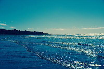
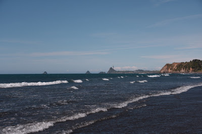
The bach and Oakura Beach
The next morning we were up early, but once again got a late start. We had to get out of the bach by 9 am for the cleaners to come in. We barely made it out the door on time.
The plan was to make the quick drive into New Plymouth, get pies for breakfast, and then get on the mountain. The Lonely Planet guide recommended Andre's Pies and Patisserie, so off we went. One of the amazing things about guidebooks is that they often publish hours of operation. Being the intrepid travelers that we are, however, we either skipped over or ignored such information. Much to our chagrin, Andre's was closed. Apparently, the world doesn't cater to our every whim (damned shame, that) so we tucked tail and slunk off to somewhere that was actually open.
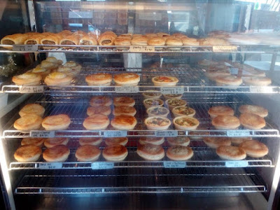

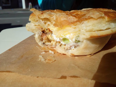
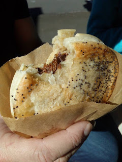


Pies and Pastries from Piccolo Morso
10 o'clock and we were finally on our way to the mountain.
According to Maori legend, Mt Taranaki used to reside in the middle of the North Island alongside the other volcanoes. Pihanga (the volcano near Lake Taupo) was coveted by the other volcanoes but she was the lover of Mt Tongariro. Taranaki and Tongariro fought over her and Tongariro won, inflicting significant damage on Taranaki. As he fled, Taranaki carved a scar into the earth to the southwest. The Whanganui River formed when Tongariro filled the valley with water to heal the rift. Tongariro's volcanic rumblings serve as a warning to Taranaki never to return and Taranaki hides his face in shame.
Taranaki hiding his face in shame is what we saw as we approached the mountain. The entire upper half was covered in thick cloud. As we drove around the north and east slopes, and started to approach from the southeast, it looked like the clouds would part and we would finally see the mountain exposed. Unfortunately, that never happened. We turned toward the mountain and started the uphill drive to the Dawson Falls visitor centre.
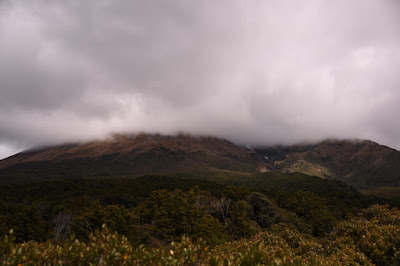
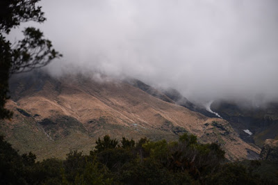
Mt Taranaki shrouded ... notice the shelter shining on the lower slope of 2nd pic
From the Dawson Falls visitor centre, there are about 20 described tramps (hikes); some only an hour or two, a bunch that take a few hours including the return trip, and several more challenging tramps that can take a couple of days.
We decided to patch together several segments of different trails. We started up through the Goblin Forest, crossing streams and trying not to get our feet wet, until we reached Wilkies Pools. The bridge at the pools was closed for repairs, so we goofed around at the pools for a while. We backtracked a little and climbed a steep switchback onto the Ridge Track. From there we headed back to the visitor centre for a snack, then finished our tour of Mt Taranaki at Dawson Falls.
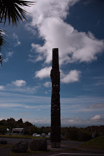

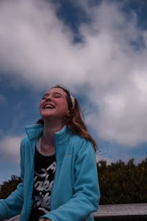
Dawson Falls visitor centre and viewing stand
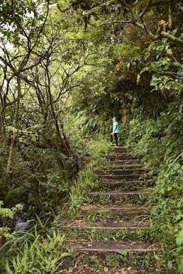

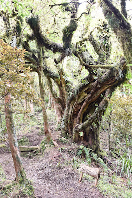
Tramping through the Goblin Forest

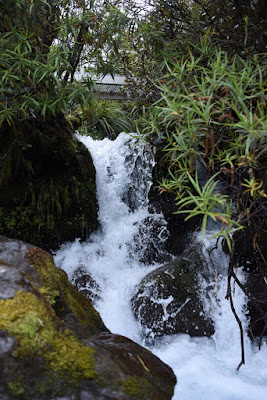

Water crossing the trail crossing the water
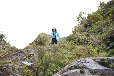


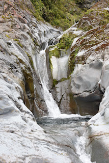
Wilkies Pools
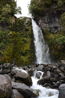


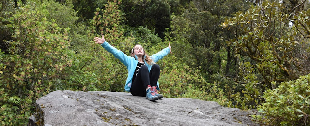
Dawson Falls
We got off the mountain and decided to keep driving the long way around in hopes of getting a clear view of the peak. The drive was through rolling farmland with endless knolls dotted with cattle and sheep. We even saw sporadic alpacas, goats, and Shetland ponies. Unfortunately, the only view we had of the snow-covered peak was a shoulder of the slope peaking through ...
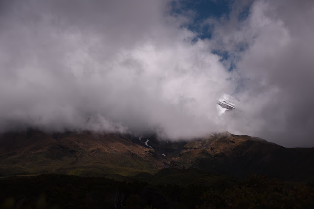
Mt Taranaki giving us the cold shoulder
We resolved to get up in the pre-dawn hours the next morning to drive around the East side of the mountain and attempt to catch the sunrise before the clouds could form. Finished exploring for the day, we made it back to the bach with plenty of time to plant our toes in the water and butts in the sand.
I am always amazed at Little H's ability to withstand sub-zero temperatures if it means putting on togs and going for a dip. It's the first weekend of December and that marks the start of the summer season here, but the water of the Tasman Sea hasn't had time yet to warm up. I'm beginning to wonder if it ever gets warm.
It's a running joke in our family that I always forget my bathing suit ... always. About every year or two, I take a stack of board shorts, each only worn once, to Goodwill. I actually remembered to pack two pairs of shorts when we left the U.S. this time. Unfortunately, they were still folded neatly in the bottom drawer in Palmy when we left for Oakura Beach. Once again, I was togless. Little Highstead was not to be deterred, so off to the beach I went wearing jandals and jeans rolled up to my knees.

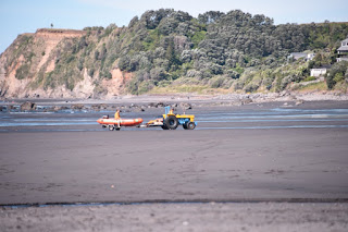
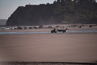



One of the really cool unique things I have noticed in NZ is the use of old rusted out and beat up tractors to pull boats of just about any size onto the beach for launch.

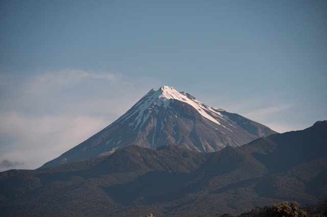
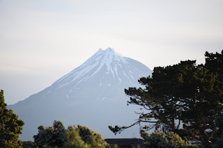
We got cleaned up from the beach and headed out to Butler's Reef, the local bar/cafe/entertainment centre. The road from the beach to the main highway faces Mt Taranaki and amazingly the clouds had cleared. Most of the cone was obscured by lower ranges but enough was exposed to show snow-cover gleaming in the sunlight. We considered turning back for the camera and eating later, but the need for food won out. We entered the restaurant, ordered food, and I went back to the bach to pick up the camera. Meanwhile, Kari searched online for the best drivable vantage points to get pictures of the mountain.
The best views require at least an hour of tramping. Going in the evening dressed for the beach didn't seem like such a great idea, so we headed into town to take pics from the Te Rewa Rewa Bridge. The more north and east we headed, the more of the mountain became exposed, however the portion in shadow increased. We decided to pull off the road and nab some pics while we could. Our best pictures of the mountain were obtained from the side of the road, standing on the rear seat and hanging out the door while getting buffeted by the wind.


Te Rewa Rewa Bridge
Tony snagged this picture to close out the day ...

Sunset on Oakura Beach
Sunday morning check-out was at 10 am. We were on the road by 9:58. This was now our 4th trip into New Plymouth, and we had a pretty good idea of where we were going and how we were getting there. New Zealand portions rival those in America. After breakfast, with full bellies and caffeinated blood-streams, we were ready to hit the road.
Kari and I travel on the road pretty well together. She sucks her teeth, grabs the "holy shit" handle, and silently critiques my driving. I speed, take corners too hard, and generally ignore her. Pilot and co-pilot/navigator works well for us. On long trips, she takes a turn at the wheel and can give me a couple hours sleep. On shorter trips, she navigates. She gives me info about turns and lane changes well in advance and has a good sense of where we are going and how to get there. She can read a map and doesn't allow the onboard navigation system to send us off into nowhere.
If I have one complaint about her navigation skills, it would be that she has absolutely no idea how far something is or how long it's going to take us to get there. If she says it will take about half an hour, I plan for 40 minutes. So when she said that she wanted to go see some rock formations on the coast, and that they were "just north of New Plymouth", I knew that we weren't going just 10-15 minutes out of our way. What I didn't plan for was a 1 hour / 70 km trek up the highway.
Our destination was Three Sisters Beach on the North Taranaki coast. Three Sisters Beach provides access to the three (now two) rock pillars that form the sisters, and another formation that takes the shape of an elephant. The best views are from the sand spits along the base of the cliffs. Unfortunately, these are only accessible during low tide. Since we couldn't walk out to the sandy areas, we drove around the river inlet and down a small road to pastures that overlook the rocks below. The cow pastures were protected by electric fences and we weren't sure if we could pass. Fortunately, as we stood there hemming and hawing, two other intrepid travels crested a knoll on the other side of the fence and headed our way. We retraced their steps and caught our first sight of the sisters.


Tramping through the cow pasture to see Elephant Rock and the Three Two Sisters

Elephant Rock?
It didn't look like much of an elephant to me ... more like a wild hog (tail to seaward, snout on the beach). But who am I to judge? I figured one man's wild hog is another man's elephant. On the drive up, we had seen a picnic area / lookout and hoped to get better pics from there. The best photos were actually from a small bridge, so we parked the car and walked back along the highway to the bridge. Finally, we had an angle that appeared to show an elephant with its trunk to seaward.

Elephant Rock
Totally weird coincidence: when we got back to Palmy that night there was a news article posted in the NZ Herald that described how part of the elephant had fallen into the water, likely during or just after the most recent large earthquake. This is how elephant rock used to look up until a month ago. It's just a reminder to get out there and explore because what is here today can so easily disappear ...

Photo pulled from the internet and I can't find photo credits.
We were a long way from home and were looking at 4-5 hours of wheels on the road time to get us there, so we turned our sights and the car southward. Before we left, we had one more task to accomplish. We had promised Little H that we would have cake by the ocean, so we sat at the picnic area / rest-stop and ate cake. Heading home, we took a pit-stop at Mike's Organic Brewery to sample their tasty wares.


A little Mike's Organic to whet the whistle.
Except for a pee and coffee break, we made the last leg of our week-end jaunt in a single stretch. This country, this journey, has been absolutely amazing. There is so much to do, see, and explore here and we have only begun to scratch the surface.

Peek-a-boo ...
No comments:
Post a Comment