Ka tito au
Ka tito au
Ka tito au ki a Kupe
Te tangata
Nana i topetope tu wenua
Tu ke Kapiti
- Te Rauparaha (1847), composed during his imprisonment aboard HMS Calliope

Driving to and from Wellington along the Kapiti Coast, when looking seaward the horizon is dominated by a large island. Kapiti Island sits just far enough offshore to appear perpetually verdant, mysterious, and unoccupied. Always looking for new places to explore, Kari discovered that it is an ecological reserve and is accessible for day trips and overnight stays. The island boasts an abundance of native plants and endemic birds, including the elusive Little Spotted Kiwi. It is one of the few places in New Zealand where one has a good chance of spotting a Kiwi (bird) in its native habitat. During our previous year here, Kari wanted to venture across Rau O Te Rangi channel and visit the island, but it was only after returning here permanently a few months ago that we were finally able to do so.
The island covers almost 20 sq km (8 sq mi), only a tiny portion of which is accessible for tramping. Almost the entirety is closed to the casual visitor and is set aside as a wildlife sanctuary. There is a limit to the number of visitors each day (100 to Rangatira, 60 to the North end). Interestingly, 13 hectares (32 acres) is privately owned by members of the Ngati Toa, Te Āti Awa, and Ngāti Raukawa Confederation. Many of them are whanau descended from an extraordinary woman, Utauta Webber, who refused to give up her land despite relentless government pressure to do so. One hundred twenty-one years after the Kapiti Island Reserve Act was established, whanau continue to live and work on Kapiti.


John Barrett and Amo Barrett, Utauta Webber's grandchildren, established Kapiti Island Nature Tours by renovating the family bach and offering a unique homestay to visitors. Manaaki Barrett, John’s son and our host/guide for the weekend, grew up visiting the island and is now slowly assuming more responsibility for the daily operations of the business. It is truly a whanau affair, structured so that as many whanau as possible can be sustainably employed and maintain ties to their ancestral lands. Maori was not initially a written language and their history was kept alive through oral story-telling. We were captivated by Manaaki’s ability to narrate the history of his whanau and iwi, and deftly weave it into their story today.


Utauta’s great grandfather, Te Rangihiroa, accompanied Te Rauparaha when Ngati Toa first seized the island in the 1820s. They successfully defended their occupation in the Battle of Waiorua (1824) when multiple iwi allied against them and tried to push them off. For Ngati Toa, Kapiti Island became a fortress and base from which to trade and launch marauding attacks. Ngati Toa developed trading relationships with whalers and fishermen from Europe and the Americas, encouraging them to live amongst them and accept Maori custom. Some married Maori women and were adopted into the tribe. As their cultures clashed, strife occasionally devolved into violence. In his book Kapiti, Chris Maclean describes Kapiti in the 1830s as “a wild frontier, a meeting point of two cultures without the restraints of law or government.” By the 1830s, the British had begun to establish a more consistent presence in the region, first sending HMS Zebra in 1833, then HMS Rattlesnack in 1838. The Treaty of Waitangi (1840) established British sovereignty in New Zealand and coincided with the decline of whaling in and around Kapiti. Whaling gave way to farming as a way of life, which only hastened the loss of native species.


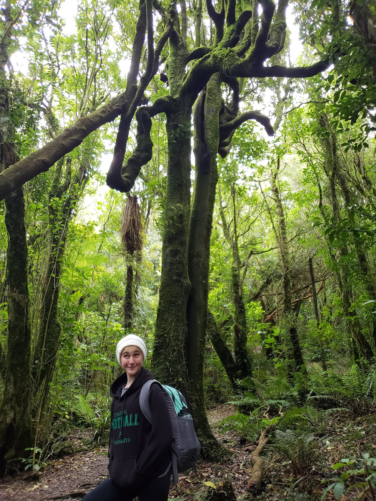
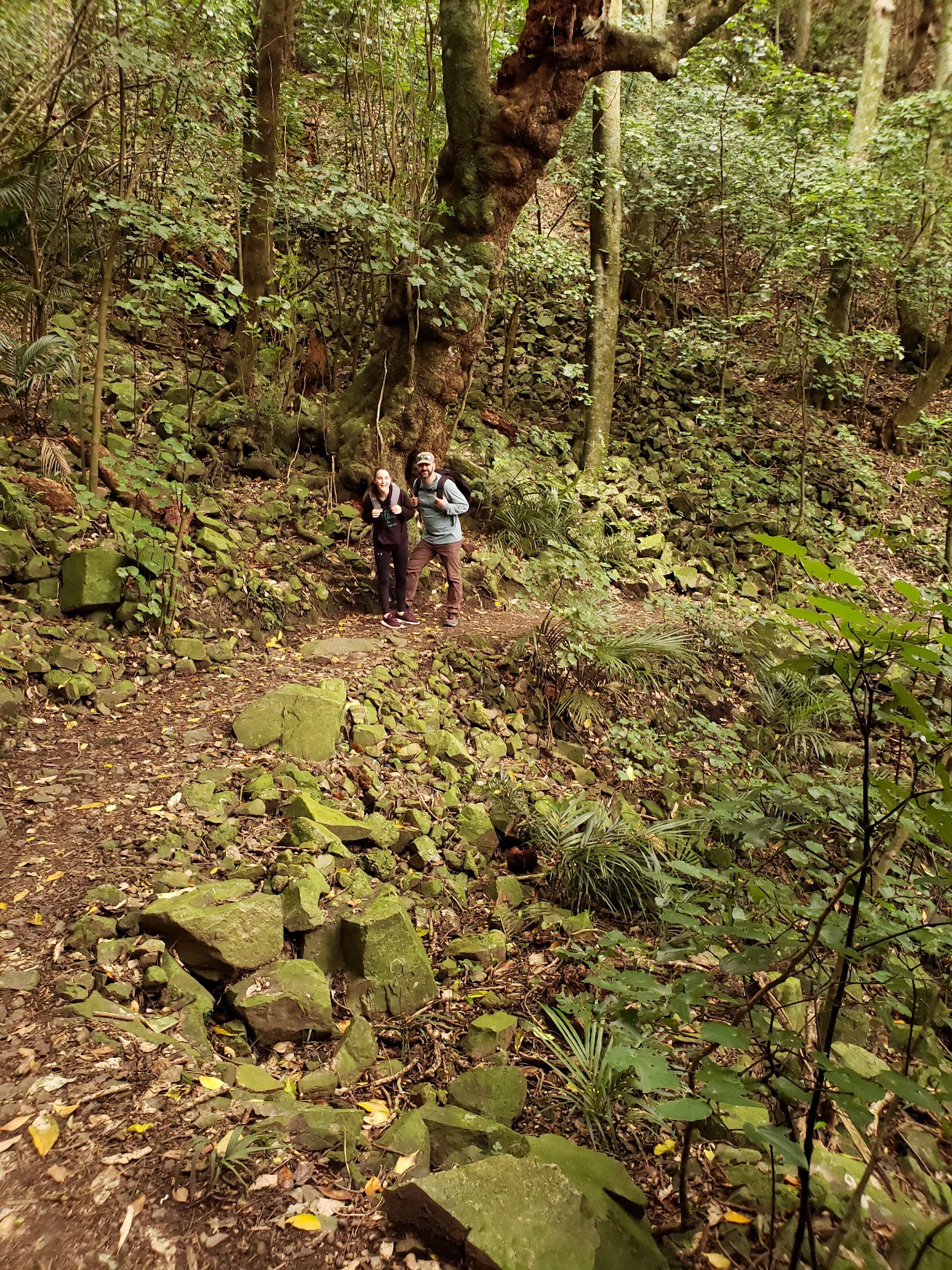

Tramping through the nature reserve. Photos: RGH & KAH

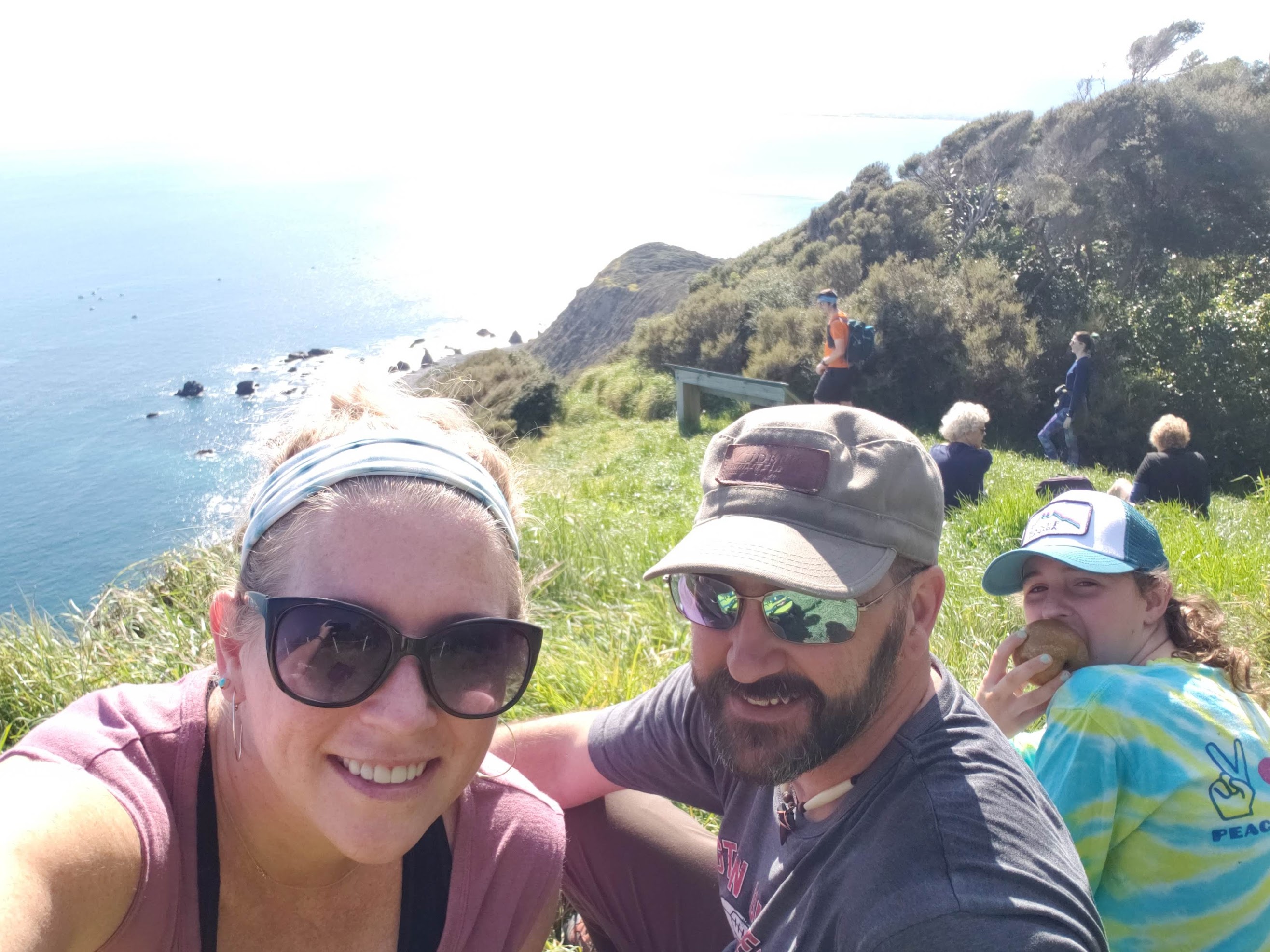
Tuteremoana summit and Western cliffs overlook. Photos: KAH
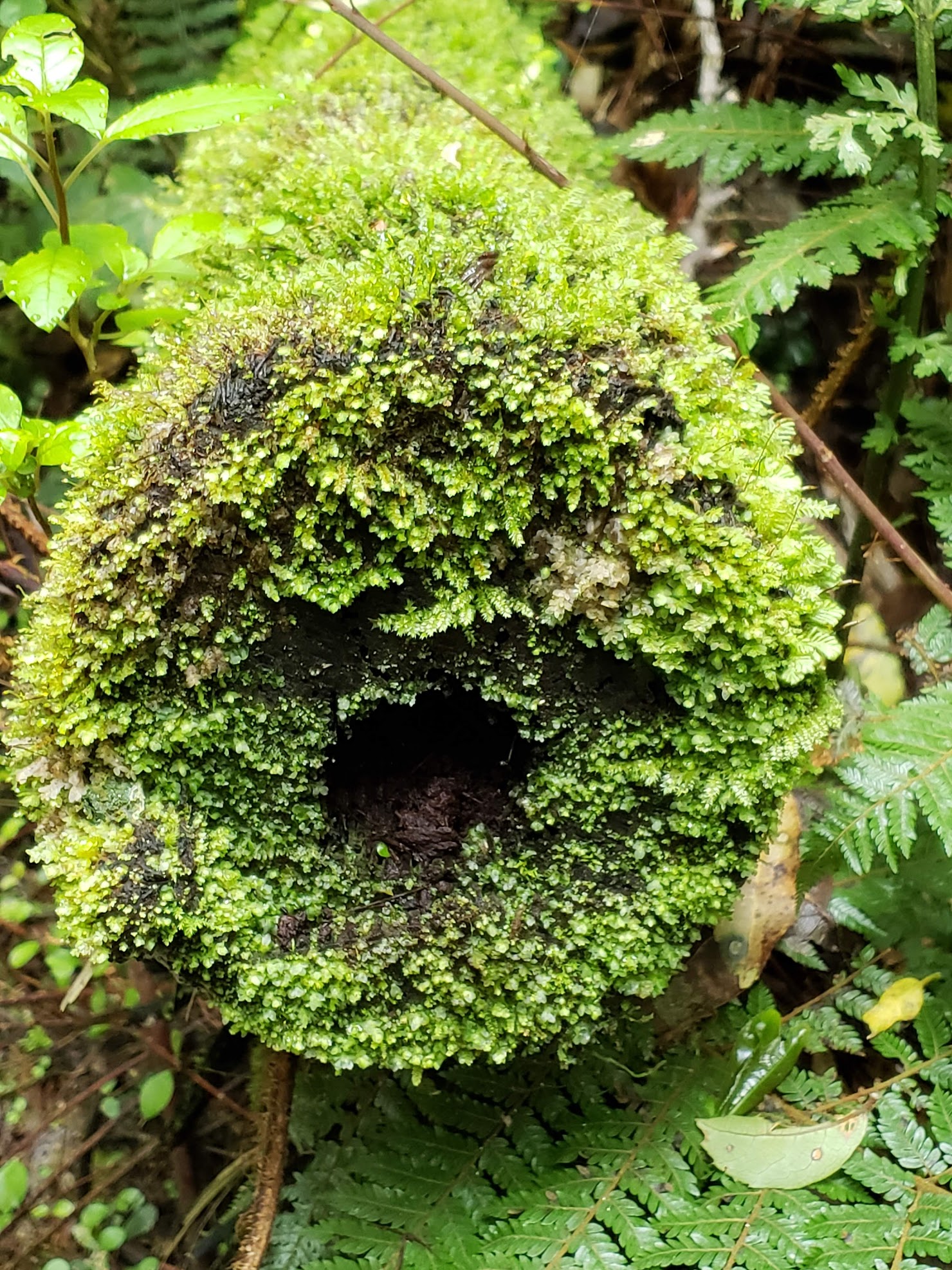
Like much of the world, New Zealand has suffered the scourge of introduced species. Prior to the capture of Kapiti Island by Ngati Toa, the human impact would have been limited to subsistence living, supported by the abundant marine life and bird species, bouyed by limited cultivation of kumara. After their occupation, the population swelled to over 1000 people and new areas were cleared for food crops. The easiest way to clear land was by burning. Occasionally, controlled burns became wildfires that swept the island. New Zealand plants and birds evolved in relative isolation, free from predators and grazing mammals. Cattle, goats, sheep, and possum were introduced by European visitors to the island, and pests such as stoats and rats established substantial colonies. The introduction of these species proved devastating. When the island became a reserve in 1897, native plants and bird populations were finally able to begin a slow regeneration.


The island covers almost 20 sq km (8 sq mi), only a tiny portion of which is accessible for tramping. Almost the entirety is closed to the casual visitor and is set aside as a wildlife sanctuary. There is a limit to the number of visitors each day (100 to Rangatira, 60 to the North end). Interestingly, 13 hectares (32 acres) is privately owned by members of the Ngati Toa, Te Āti Awa, and Ngāti Raukawa Confederation. Many of them are whanau descended from an extraordinary woman, Utauta Webber, who refused to give up her land despite relentless government pressure to do so. One hundred twenty-one years after the Kapiti Island Reserve Act was established, whanau continue to live and work on Kapiti.
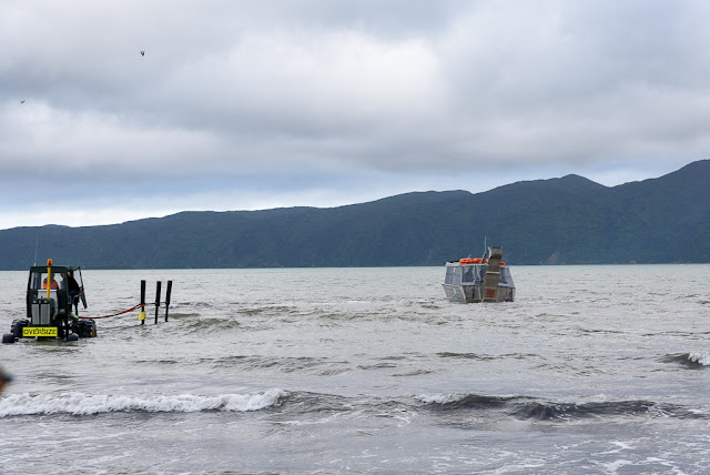
Paraparaumu to Kapiti Island. Photos: RGH
John Barrett and Amo Barrett, Utauta Webber's grandchildren, established Kapiti Island Nature Tours by renovating the family bach and offering a unique homestay to visitors. Manaaki Barrett, John’s son and our host/guide for the weekend, grew up visiting the island and is now slowly assuming more responsibility for the daily operations of the business. It is truly a whanau affair, structured so that as many whanau as possible can be sustainably employed and maintain ties to their ancestral lands. Maori was not initially a written language and their history was kept alive through oral story-telling. We were captivated by Manaaki’s ability to narrate the history of his whanau and iwi, and deftly weave it into their story today.
Kapiti Island Nature Tours. Photos: RGH & KAH
Utauta’s great grandfather, Te Rangihiroa, accompanied Te Rauparaha when Ngati Toa first seized the island in the 1820s. They successfully defended their occupation in the Battle of Waiorua (1824) when multiple iwi allied against them and tried to push them off. For Ngati Toa, Kapiti Island became a fortress and base from which to trade and launch marauding attacks. Ngati Toa developed trading relationships with whalers and fishermen from Europe and the Americas, encouraging them to live amongst them and accept Maori custom. Some married Maori women and were adopted into the tribe. As their cultures clashed, strife occasionally devolved into violence. In his book Kapiti, Chris Maclean describes Kapiti in the 1830s as “a wild frontier, a meeting point of two cultures without the restraints of law or government.” By the 1830s, the British had begun to establish a more consistent presence in the region, first sending HMS Zebra in 1833, then HMS Rattlesnack in 1838. The Treaty of Waitangi (1840) established British sovereignty in New Zealand and coincided with the decline of whaling in and around Kapiti. Whaling gave way to farming as a way of life, which only hastened the loss of native species.
Tramping through the nature reserve. Photos: RGH & KAH
Tuteremoana summit and Western cliffs overlook. Photos: KAH
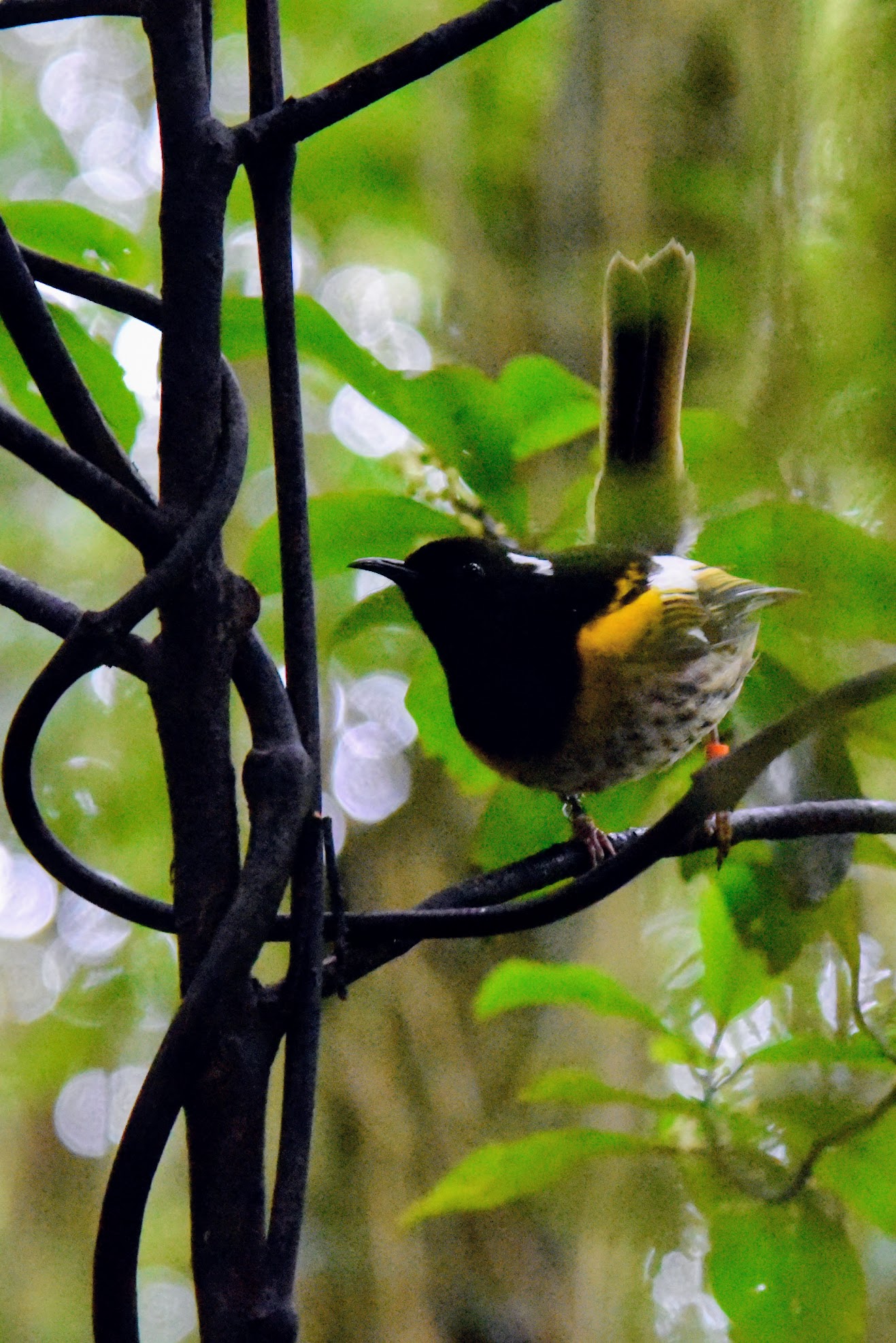
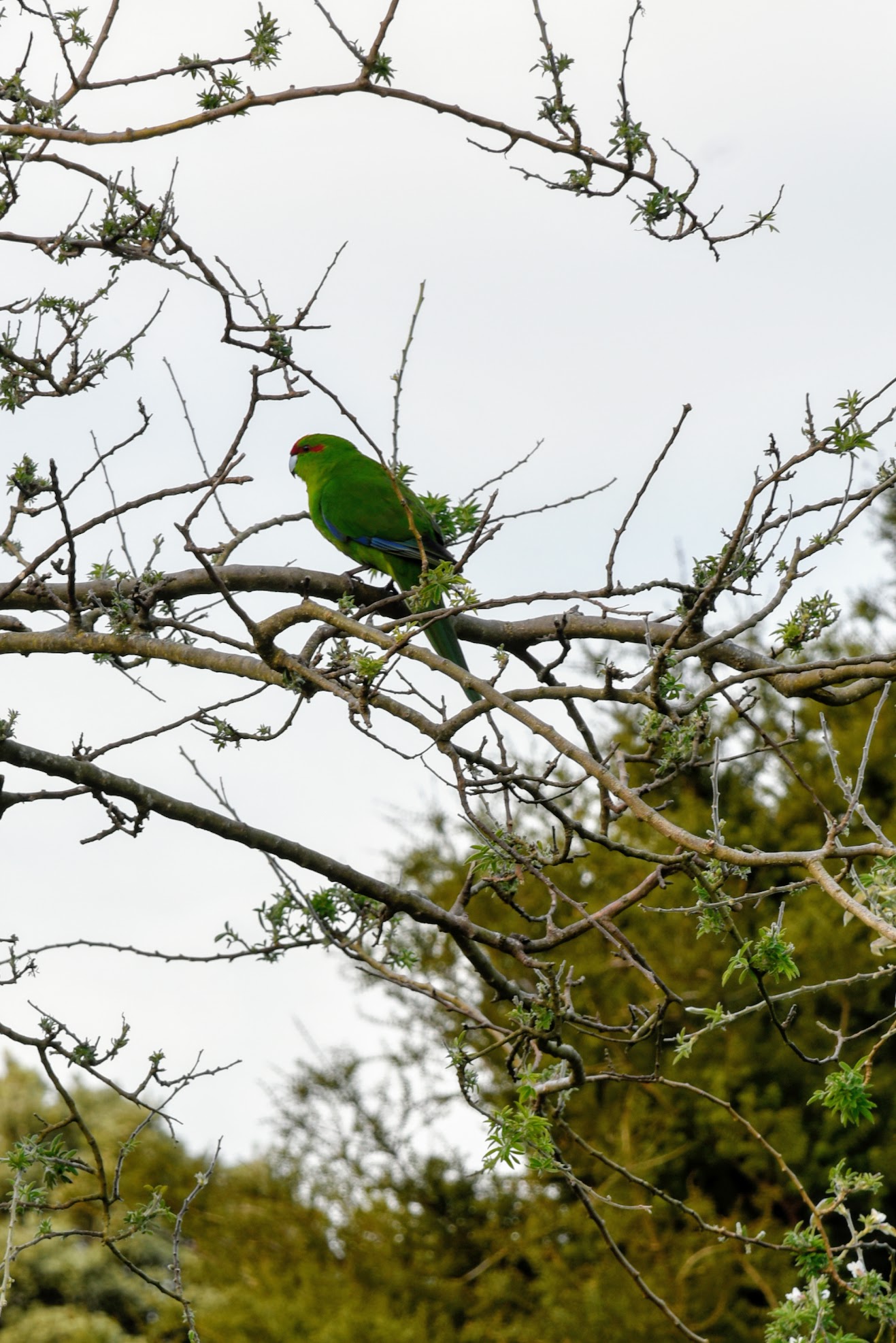
Hihi & Kakariki. Photos: KAH
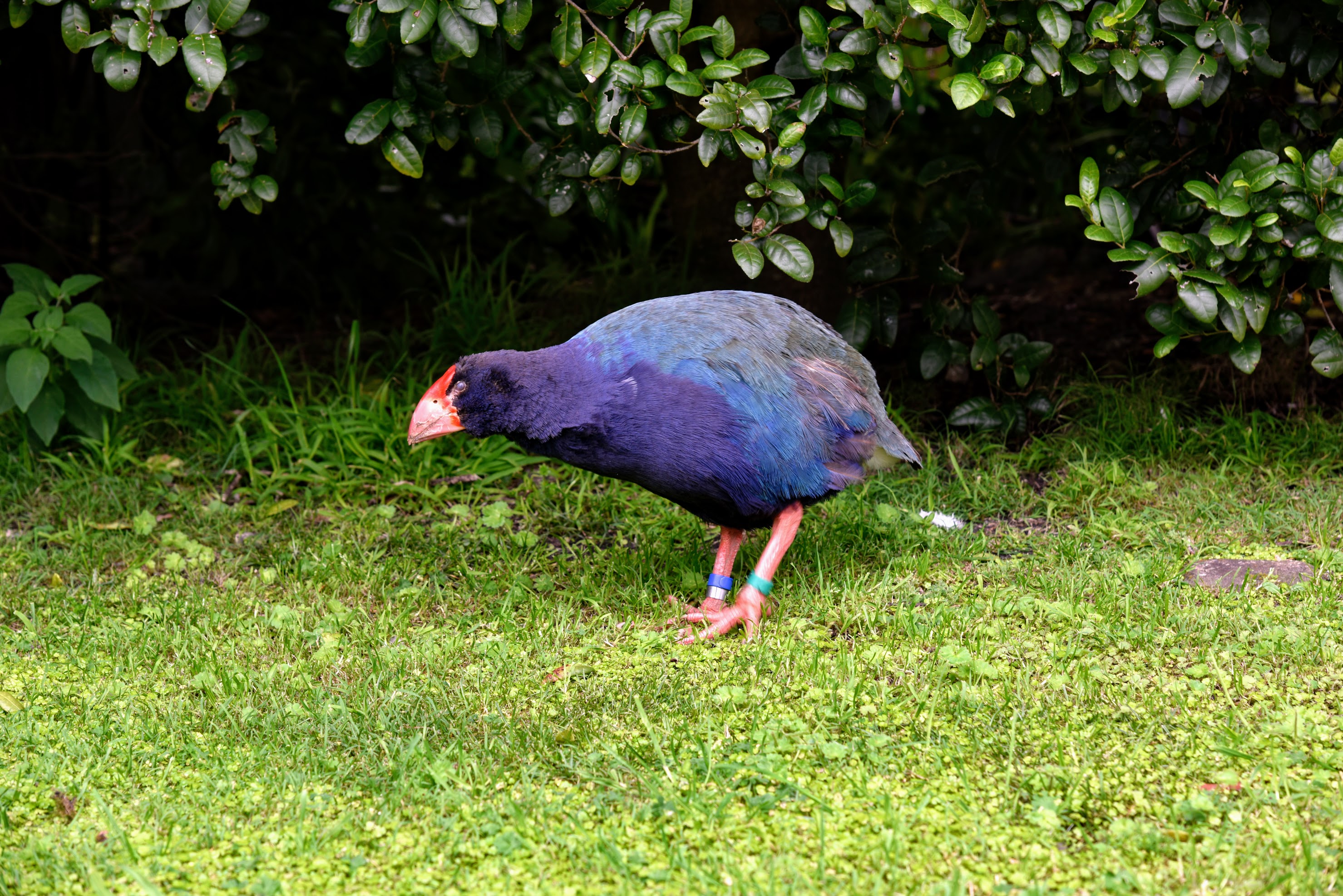
Takahe. Photo: KAH
Kereru. Photo: KAH
Kaka. Photos: RGH
By 1917, a campaign to clear the island of grazing mammals and predatory pests had begun, but limited farming continued on the island into the 1950s. It would take almost 80 years before the last rat, and last mammalian pest, would be cleared from the island and endemic species could flourish. Visiting the island today, it is the abundance and variety of native birds that are most impressive. Supported by the regeneration of native plant species, some have rebounded from in-place populations, while others have had to be re-introduced. This concerted effort to restore native bird species, with Kapiti Island acting as a “life raft”, has been so successful that some are transplanted from the island to bolster or re-establish populations elsewhere in New Zealand.
Sunrise over Waiorua Bay. Photo: RGH
Manuka & view of Northern shore from Western cliffs. Photos: KAH
Kapiti Island is one of the few areas where you might chance to see a Kiwi bird in the wild. "Might chance" is a bit of a misnomer ... we set out late at night with Wayne, one of the year-round residents, in search of these hard-to-find birds. Kapiti Island is far enough from the mainland that there is little light pollution, and it was a cloudy, nearly moonless night. More than once, I bumped into the person in front of me when they stopped abruptly. Using a light shrouded with red cellophane, Wayne crawled around on his belly looking into the dense underbrush. There were 13 of us split into two groups, and ours was the only one to actually spy a Little Spotted Kiwi in the bush. Admittedly, it was a bit anti-climactic, but it was pretty awesome none-the-less.
One of New Zealand's many great small breweries.
The next morning, the skies were clear and the sun was shining. We opted to take the afternoon boat back across Rau O Te Rangi channel, giving us a chance for a morning tramp to the top of the Western cliffs. After lunch, we set out on a guided tour of the Northern shoreline and bird nesting area. We thought we would be a little late getting to the boat landing, but were there in plenty of time to sit for a spell. Once across to the mainland, we stopped to slake our thirst and eat our fill of pizza at the Tuatara Brewery, then it was on to home.
Rats ...